Les Vuardes and alpage de Vormy - Hiking
3 Couvagnes Road
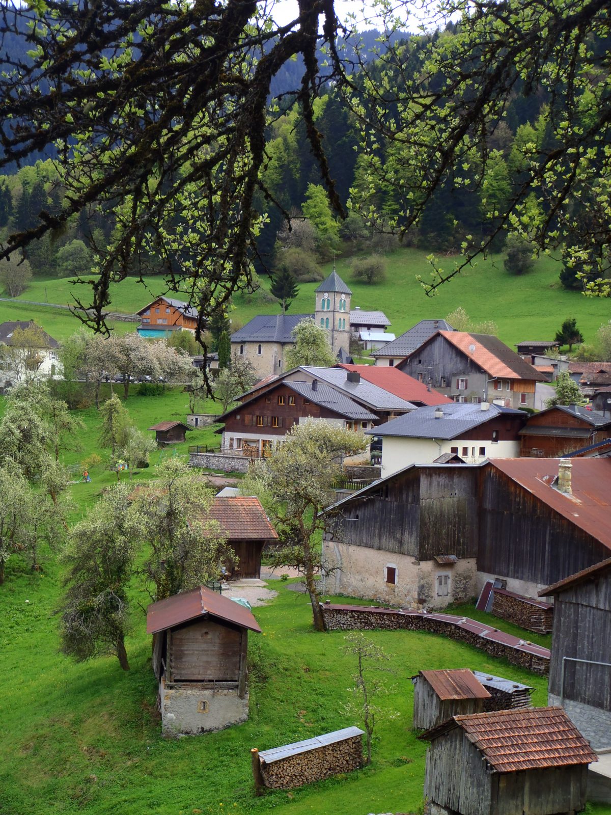
Hamlet of Romme
Parking near the bus shelter
74300 Nancy sur Cluses
Distance: 18 km
Duration: 315 min
Elevation: 910 m
TAG
Beautiful and long hike, allowing you to gain height to overlook the hamlet of Romme up to the Col de Gueule à Vent. On the foothills of the Aravis chain, discover the local mountain pastures in magnificent mountain landscapes.
Near Cluses-Scionzier, this round trip route starts from the hamlet of Romme, a small mountain village in a preserved and authentic setting.
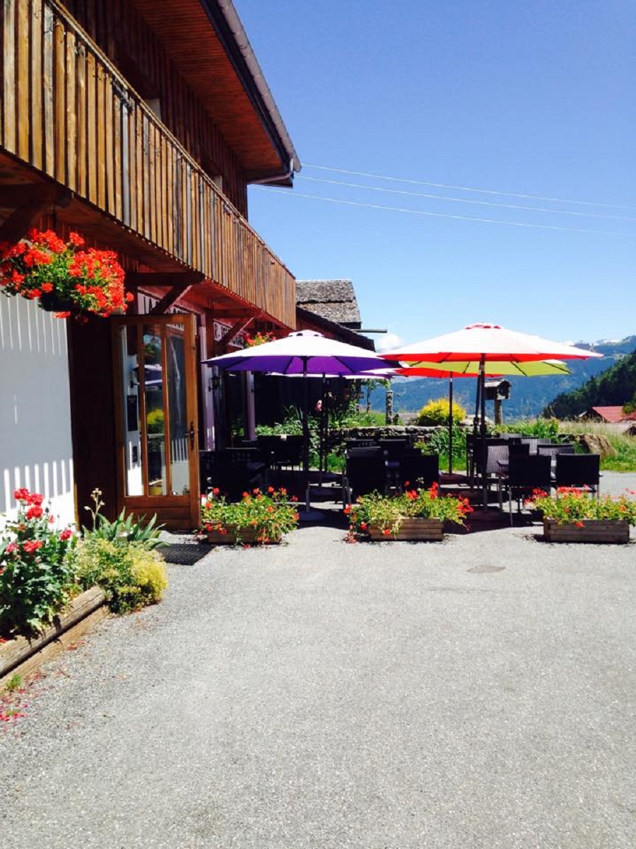
Go and meet the Alpine farmers of the Chalets de Vormy, the opportunity to immerse yourself in an agricultural area typical of our mountains and to leave with the cheese produced on site.
From the mountain pasture of Vormy, the path levels out little by little, leaving the possibility of admiring the numerous panoramas of Mont Blanc and the surrounding peaks.
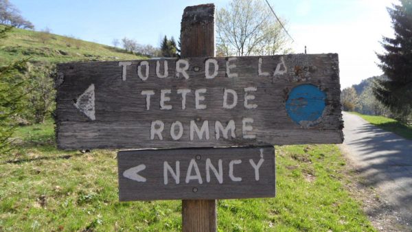
At the foot of Pointe d'Areu, the route continues to the aptly named Col de la Geule à Vent. The chain of Bargy is then revealed at the bend of a superb point of view.
Topo / step by step
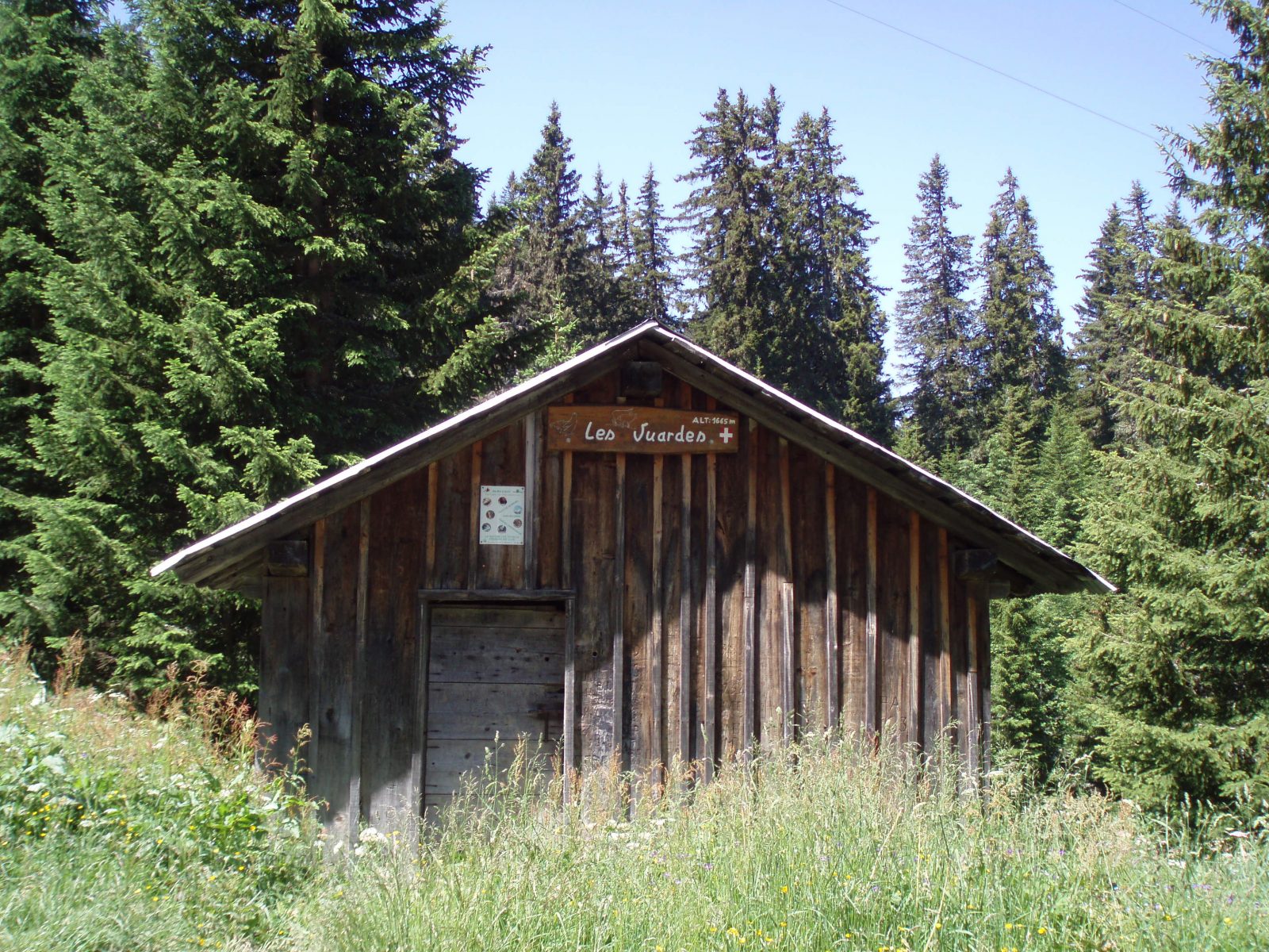
Departure: Romme1 car park/ From Romme, take the direction of "Pointe d'Areu". Always follow the direction "Pointe d'Areu", you will pass by "Romme", "Le Creux de Sable", "Les Lays", "Chalet des Vuardes", "Porzet", "Sous la Tête de la Sallaz" then " Sur Chalet de Vormy"2/ From "Sur Chalet de Vormy", follow the direction of "Col de la Gueule à Vent". Continue to follow this direction passing by the "Chalets de Vormy" and "Sous Tête des Muets"3/ Arrived at the "Col de Gueule à Vent", begin the return by the same route as on the outward journey by following "Sur Chalets de Vormy". At "Sous Tête de Muets", always follow the same route as on the outward journey, heading towards "Tête de la Sallaz". From "Sur Chalets de Vormy", always follow the direction "Romme" via the same route as on the outward journey.
Route
From Cluses, take the D119, direction Nancy-sur-Cluses. Go through Nancy, and continue on the D119, to Romme station. Cross the hamlet of Romme and park at its exit in a car park with a bus shelter and a pool.
In detail
- 46.029498
- 6.572747
- From Cluses, take the D119, direction Nancy-sur-Cluses. Go through Nancy, and continue on the D119, to Romme station. Cross the hamlet of Romme and park at its exit in a car park with a bus shelter and a pool.
- Distance: 18 km
- Markup: BALISE
- Positive elevation: 910 m
- Vertical drop: 910 m
- Daily duration: 315 min
- Type of route: GO_RETOUR
- Marking precision: Path marked with directional posts (PDIPR)
- Type of land: Earth
Opening
From 01 / 04 to 15 / 11.
Subject to favorable weather conditions.
Prices
Free access. Topo rando on sale at the tourist office.
Equipments & services
Equipments
- Picnic area.
- Public toilets
Services
- Pet Friendly
- Catering